

Dr. Fabio Sasahara
Recurring congestion has been documented along New York State Route 17 within the transportation corridor during weekday commuter periods and recreational Friday and Sunday peak travel periods. These conditions include reduced travel speeds and, at times, stop-and-go traffic.
To better understand these conditions, the New York State Department of Transportation (NYSDOT) initiated the NYS Route 17 Mobility and Access Improvements Project to evaluate the causes of congestion and assess potential solutions to address both existing and future operational needs within the transportation corridor.
As part of the Project, a comprehensive traffic analysis was conducted during the Scoping Phase for approximately 30 miles of NYS Route 17 between US Route 209 and Interstate 87 in Orange and Sullivan Counties. The analysis was led by Prime Consultant, WSP USA, Inc., and utilized Highway Capacity Software (HCS), developed by the University of Florida’s McTrans Center, as part of the Scoping Phase traffic analysis to evaluate traffic operations and capacity performance within the transportation corridor. McTrans also provided independent technical review of the analysis to support the reliability of the modeling approach and results.
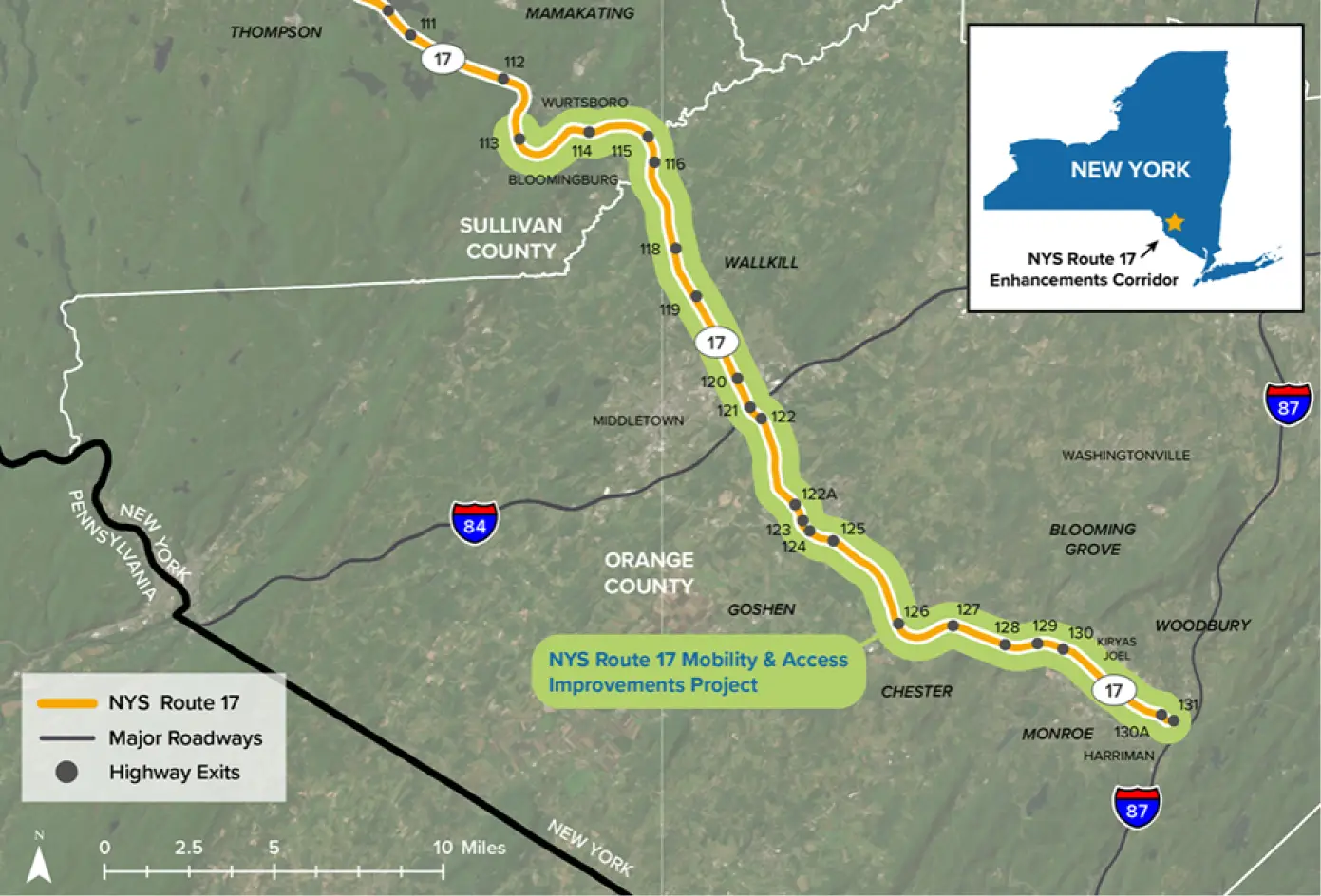
Route 17 Project Location (Source: NYS Department of Transportation)
The use of HCS was limited to the Scoping Phase of the Project and supported the identification and screening of potential feasible concepts:
- Concept 1: Targeted Operational Improvements
This concept focuses on auxiliary lanes and collector-distributor (C-D) roads at critical locations to mitigate ramp turbulence and address localized bottlenecks. - Concept 2: Peak Period Shoulder Lane with Select Third Lanes
This alternative introduces part-time shoulder running during peak periods, combined with limited full-time lane additions and interchange improvements. - Concept 3: Continuous Third General Purpose Lane
This alternative adds a continuous third lane through the most congested segment, along with C-D roads and interchange reconfiguration to improve both capacity and safety.
Subsequent traffic analyses conducted for this DDR/DEIS utilized refined methodologies and tools appropriate for detailed evaluation of the Build Alternatives.
The transportation corridor includes multiple closely spaced interchanges and short weaving segments, which influence traffic operations and contribute to recurring congestion and operational variability during peak travel periods. These conditions were evaluated to inform the identification and development of operational and geometric improvements.